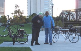
This is a brief description of the bicycle ride I took with my buddy Sam a couple of weeks back. I didn't find a lot online describing this leg of the Ohio to Erie bike trail, so I wanted to make some notes for my future use and that of other riders.
Equipment: We rode mountain bikes with chromoly frames and aluminum rims. Mine is a 5-year-old Diamondback with front shocks. Sam’s was a 20-year-old Ross, stiff frame.
The Ohio to Erie Trail
The first thing you should know is that the Ohio to Erie trail, which stretches from the Ohio River to Lake Erie (hence the name), is a 325 mile, limited access, paved trail for bikes, skaters, equestrians and peds that is supposed to be about 70 percent complete.
Much of the trail is built on train tracks. Other parts run the path of the old Erie Canal. (I believe this is called the Towpath trail, stretching north of Columbus, though I haven't ridden this section yet. You may recall that donkeys and horses towed boats along the canal, hence this name.
Context
As I understand it, there are trails like this webbing the whole US. I would like very much to ride cross country with my son, Ulysses, one day.
Starting at 64 King
64 King is the address and home to our friends, the Landing Place community. LP is an intentional Christian community like the one in which my wife Becky and I live - Vineyard Central.
Sam and I left at about 7 a.m. on a cold Saturday morning. Heading west from the intersection of High Street and King, near Ohio State University Campus, we rode about a mile to the Olentangy River. A bike path, with several dead ends, eventually leads to the Scioto river. From there, we opted to take 40 West - West Broad Street from Downtown. The trail may continue a bit here, but we were not certain how far. Part of it, a bridge, was being torn down. I'd be very interested in any info anyone has on this leg of the trail. Earlier we ran into a section that was closed by barbed wire and chain link fence. Why is this? Strange. At the Scioto River we encountered a full scale replica (surprisingly small) of the Santa Maria. Many homeless sleeping at the riverbank, too.

We travelled 40 West for about 8 miles to the intersection of I-270, the city's beltway. This part was a lot of sidewalk riding. Pretty flat. Lots of places to eat or use the bathroom.
Just before I-270, we dropped south on Georgesville Road - highway riding, limited berm. Drivers were reasonable and got over for us, but I don't like narrow, 1 foot shoulders. It gets rural at this point. We took Georgesville Road to Aikire Road and headed Southwest to Georgesville.
***If you break down – On Georgesville Road, just south of 40W, there's a Meijer. We picked up a tire there when Sam’s innertube began to bulge through the sidewall. From now on we’ll carry spares, but Meijer is a godsend. Next closest places for civilization and bike parts are London and Columbus.
**Bring extra water – even on a cold day (50 degrees) we drank a lot and could have had more if we had been carrying it.
Georgesville was unremarkable. We hitched a ride for part of this because the road was a two lane highway. We came this route, btw, because we were searching for the trail between downtown Columbus and Lily Chapel. It doesn't exist here yet, as far as I can tell.
Aikire Road leads to Lily Chapel. It becomes Lily Chapel-Georgesville Road. Train tracks run parallel to this road. Will that be the trail one day? Any readers with advice on this, please comment.
In the town of Lily Chapel, which looks very small and quiet to me - lots of farms, not much industry - we proceeded towards the large grain silo (some sort of tall, cyclidrical structure, anyway) that marks the center of town. We headed straight past the cross road that leads to the towers and on to CR-103/Wilson Road. We made a right on Wilson and headed toward and then past a radio tower. Just past the tower is the trailhead of the Lily Chapel trail.
The Lily Chapel to London Trail
This is a very difficult stretch. I'd guess it's 12 miles long. All of it is gravel, which makes any sort of travel very difficult. We spent a lot of energy grinding rocks and moving very slowly. There are no amenities except beautiful scenery and peace. Bring extra water for this stretch. Private residences don't appear until you're a couple of miles from London.

We arrived in London at 5 p.m. It's a quick left off the trail and then the first right on 665 (the Lily Chapel trail runs roughly parallel to 665) We were dazed from the long ride and took a left at first. Our minds played tricks on us. There's plenty of good food and stops in this town, when you take the right turn. We ate at Ronetti's, a fine little Italian place with big pizzas and reasonably priced beer.
45-50 Miles at 10 hours. Slow going. We slept really well at the end of the day.


2 comments:
Unfortunately, the area you were biking is perhaps the least developed of the Ohio to Erie. Biking from Cincinnati to London is a very good ride
dude, that was a great trip. i need to send this link to my family.
Post a Comment